
SuAsCo
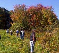
Photo Courtesy of Nancy Burke
Walking through meadows by the reservoir
In 1968 the state started construction of the SuAsCo (Sudbury Assabet Concord Rivers) impoundment in Westborough. This is a 380-acre area stretching from Shrewsbury to Mill Road in Westborough. The land surrounding the reservoir is an annex of Quinsigamond State Park.
This reservoir is also known as Mill Pond or Stump Pond. The latter name comes from the decision to leave the trees standing when the reservoir was constructed. This has made a wonderful habitat for nesting birds.
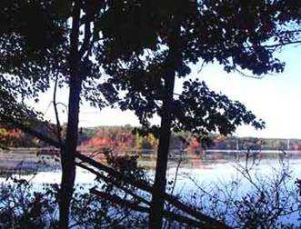
Photo Courtesy of Nancy Burke
Reservoir in the fall
Working with the Department of Environmental Management, the Westborough Community Land Trust has built trails from the Headwaters Conservation Area along the south shore to the boat ramp on Mill Road. Using a set of existing and new trails, WCLT has worked along the north shore from Mill Road to the western end of Fisher St.
WCLT is exploring possibilities for extending the trail further around the pond.
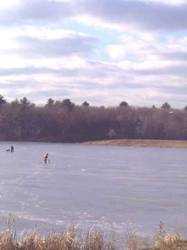
Photo Courtesy of Don Burn
Ice Fishing on the reservoir
![]()
![]()
![]()
![]()
![]()
![]()
![]()
Map to Andrews Street Entrance
Headwaters Conservation Area (previous segment of the Charm Bracelet)
No next segment of the Charm Bracelet (at this time )
Westborough Community Land Trust, PO Box 838, Westborough , MA 01581
-- Contact -- Join! --